Additional flood warnings
- A flash flood warning has been issued for northwestern Burlington County, northwestern Camden County and northwestern Gloucester County, effective from 5:25 p.m. to 11:30 p.m. Wednesday.
- The National Weather Service’s New York regional office has issued a flood warning for the Ramapo River near Mahwah, affecting Bergen and Passaic counties in New Jersey and Orange and Rockland counties in New York. The warning is effective from late Wednesday night through Friday morning. As of 3:30 p.m. Wednesday, the river level was at 4 feet, but it is expected to rise to 8.5 feet late tonight into Thursday morning, a half-foot above flood stage, the weather service said. Minor flooding is expected along Route 202, but if the river rises to 9 feet, moderate flooding will occur on Route 202 and Route 17.
- The Saddle River near Lodi in Bergen County, where major flooding is forecast. “The river is expected to rise above flood stage late this evening to a crest of 10.5 feet just after midnight tonight,” the warning says. “It will then fall below flood stage early tomorrow afternoon.”
- The Millstone River at Blackwells Mills in Somerset County, where moderate flooding is forecast from late Wednesday night to Friday evening. “The river is expected to rise above flood stage late tonight to a crest of 11.5 feet tomorrow evening,” the warning says. “It will then fall below flood stage early Friday afternoon.”
- The South Branch of the Raritan River in Stanton, affecting Somerset and Hunterdon counties, where major flooding is expected.
- The North Branch of the Raritan River in Raritan, affecting Somerset County, where major flooding is expected.
- The Raritan River in Manville, affecting Somerset and Middlesex counties, where major flooding is expected.
- The Raritan River in Bound Brook, affecting Somerset and Middlesex counties, where major flooding is expected.
- The Pequannock River below the Macopin Dam in Morris County, where moderate flooding is expected.
- The Passaic River in Chatham, affecting Morris and Somerset counties, where moderate flooding is expected
- The Passaic River in Pine Brook, affecting Morris, Essex and Passaic counties, where moderate flooding is expected.
- The Passaic River above Singac, affecting Morris, Essex and Passaic counties, where moderate flooding is expected.
- The Passaic River in Little Falls, affecting Essex and Passaic counties, where moderate flooding is expected.
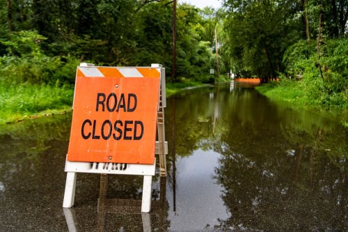
Even before the warnings were issued, the entire state was under a flash flood watch, with the National Weather Service saying “numerous instances of flash flooding are likely through predawn Thursday, with some events possibly significant, since the ground is saturated from recent heavy rain events.”
The weather service also said “widespread river flooding is likely to occur if storm total rainfall forecasts are realized. Roads and structures along particularly susceptible rivers, creeks, and streams may be impacted.”
Forecasters say another wave of thunderstorms will be sweeping across New Jersey later Wednesday afternoon and Wednesday night, and some of the storms could be volatile enough to spark an isolated tornado.The National Weather Service believes the northern region of New Jersey faces the biggest threat of torrential rain — possibly as much as 4 to 6 inches — that could trigger flash flooding on roads as well as widespread flooding from rivers and streams that overflow their banks.


